Streams in the Desert: Rain and Rocks in Death Valley National Park
The desert southwest is a captivating place, and Death Valley is certainly no exception! The largest National Park in the lower 48 states, Death Valley is well-known for being a land of extremes: hottest, driest, lowest. It is a land of dramatic scenery, hardy desert plants and animals, and an impressive geologic record.
Over the Presidents' Day weekend, I was able to spend several days exploring Death Valley with a geology field studies class from Modesto Junior College. (Last September, I went on a similar trip to Northern California where I studied geology at Mount Shasta, Lava Beds National Monument, and Lassen Volcanic National Park, as well as botany on the Modoc Plateau.) Never pass up a good learning experience!
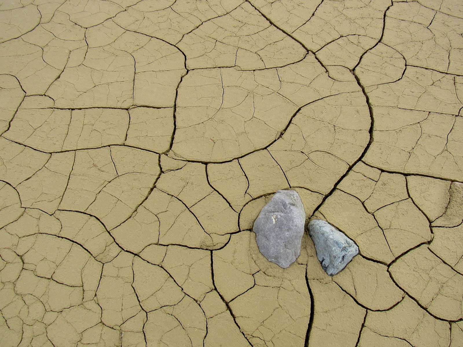
While we were in Death Valley, an unusual thing happened: it rained! A storm came through and showered us with rain for two days and two nights, almost without stopping. But thanks to having the right gear, I stayed warm and dry the whole time. Don't underestimate the importance of a good tent, raincoat, and waterproof boots, even in the desert! Being prepared will go a long way toward making a rainy camping trip much more enjoyable. Seeing rain in Death Valley gave me a much better understanding of flash floods and the geologic effects these massive torrents of water occasionally have on the landscape. It's hard to imagine that there is ever that much rain in the desert, but as I have learned, it does happen!
Thanks to the beautiful rain, we were able to experience a side of Death Valley not many tourists get to see. Streams were flowing, tiny rivulets gathering into larger channels and running across the desert to collect in low spots (low spots like Badwater Basin and the spot right underneath my tent!) The air was clean and clear, and the rocks were bright and vivid when the sun eventually came out.
Death Valley is in the Basin and Range geomorphic province, an area defined by a series of north-south trending fault valleys and mountain ranges. The fault valleys are known as grabens, blocks of land that have sunk between parallel mountain ranges, called horsts. These valleys were formed as the earth's crust stretched over time, breaking and tilting blocks of land into the horst and graben landscape we see today. (In German, horst means an eagle's nest or eyrie, and graben means grave.)
 The aridity of the desert preserves an ancient landscape, allowing geologists to reconstruct a vast history of the region as they interpret the rocks. The Death Valley we see today is really the second fault valley or graben that has formed here. Extensional forces have been pulling the crust apart to create the horst and graben landscape in the Death Valley region for 15-16 million years. Around 5-6 million years ago, a northwest-southeast trending fault valley opened. Mountains rose on either side and erosion filled this "original Death Valley" with layers of sediment that were then lifted by faulting and exposed through erosion. At times, a lake in the valley deposited layers of silt and clay; at other times, dry conditions left behind deposits of salt, borate and gypsum. Alluvial fans deposited conglomerates and volcanic eruptions created colorful deposits of ash and tuff. These layers, part of the Furnace Creek formation, are exposed at Zabriskie Point. The graben we call Death Valley today formed between 2 and 3 million years ago; a relatively recent addition to an otherwise ancient landscape.
20,000 years ago, Death Valley was a grassy savannah with a warm, moist climate. A large, freshwater lake, Lake Manly, filled the fault valley to a depth of 600 feet with runoff from melting glaciers during the Ice Age. Mudstone formed at the bottom of the lake. 11,000 to 12,000 years ago, the climate shifted to become warmer and drier, causing the lake to shrink and eventually dry up, leaving salt and mineral deposits behind, which can be seen at the well-known salt flats at Badwater Basin.
Badwater Basin is a famous tourist destination known for being the lowest point in North America at 282 feet below sea level. Beneath Badwater, there are between 9,000 and 11,000 feet of sediments that have washed down from the mountains over the millennia.

The Black Mountains, which rise up several thousand feet above Badwater to the east, are composed of ancient rock, 1.7 billion years in age. Exposed in these mountains is a metamorphic core complex, the literal "roots of the mountain," or basement rocks that were brought to light through uplift and erosion as extensional forces created the Death Valley graben 2-3 million years ago. Geologists believe the sloping side of these mountains is the fault plane of a detachment fault (a low angle normal fault), and that as younger rock slid off along the fault plane, these mountains slowly rose. The formations in the picture below, where metamorphic basement rocks are exposed, are called Turtlebacks.
The Mesquite Flat sand dunes are a beautiful sight, especially with the snow-capped Grapevine Mountains as a backdrop. A few of my classmates and I explored these dunes at night, climbing one hill after another until we were far enough from the road to sit in silence. Once we were deep in the dunes, we shut off our headlamps and let our eyes adjust to the darkness. As clouds drifted across the sky, Venus and familiar constellations blinked on and off. We sat in the sand dunes for almost two hours, soaking in as much wonderment and awe as we could (which is not a hard thing to do on a starry desert night). From Mesquite Flat sand dunes, it was about a two-mile hike across the desert back to our camp at Stovepipe Wells.
The Mesquite Flat sand dunes formed as wind carrying fine particles of quartz and feldspar, likely weathered from the Cottonwood Mountains to the north and northwest, sweeps down the valley, only to be interrupted by Tucki Mountain at the northern end of the Panamints. This interruption in the wind current results in eddies which slow the wind, causing it to drop its load of sand in the area where the dunes have formed.

If you ever get a chance to visit Death Valley (in the cooler months), take it! It's a wild, remote, fascinating place, with a stark beauty that is sure to captivate. Geologists, botanists and adventurers alike will find more than enough to enthrall them for days on end. But remember to be prepared: the desert, for all its beauty, is a harsh and dangerous place. Carry and drink more water than you think you need, wear sunscreen, sunglasses and a hat. But also bring warm, waterproof clothes (in layers) and sturdy boots! A good, properly staked-out tent is important if you plan to camp. It does rain occasionally in the desert, and strong winds are always likely!
Happy adventuring!

 |
| Uplifted and tilted layers of ancient lake sediments, alluvial fans and volcanic ash deposits are found in the Furnace Creek formation, exposed at Zabriskie Point. |
Over the Presidents' Day weekend, I was able to spend several days exploring Death Valley with a geology field studies class from Modesto Junior College. (Last September, I went on a similar trip to Northern California where I studied geology at Mount Shasta, Lava Beds National Monument, and Lassen Volcanic National Park, as well as botany on the Modoc Plateau.) Never pass up a good learning experience!
 |
| Water in Badwater Basin (a rare sight) |
While we were in Death Valley, an unusual thing happened: it rained! A storm came through and showered us with rain for two days and two nights, almost without stopping. But thanks to having the right gear, I stayed warm and dry the whole time. Don't underestimate the importance of a good tent, raincoat, and waterproof boots, even in the desert! Being prepared will go a long way toward making a rainy camping trip much more enjoyable. Seeing rain in Death Valley gave me a much better understanding of flash floods and the geologic effects these massive torrents of water occasionally have on the landscape. It's hard to imagine that there is ever that much rain in the desert, but as I have learned, it does happen!
 |
| Stream channel above Gower Gulch, through which water has been diverted in hopes of preventing floods. (The diversion didn't actually work.) |
Thanks to the beautiful rain, we were able to experience a side of Death Valley not many tourists get to see. Streams were flowing, tiny rivulets gathering into larger channels and running across the desert to collect in low spots (low spots like Badwater Basin and the spot right underneath my tent!) The air was clean and clear, and the rocks were bright and vivid when the sun eventually came out.
 |
| View toward Gower Gulch |
Death Valley is in the Basin and Range geomorphic province, an area defined by a series of north-south trending fault valleys and mountain ranges. The fault valleys are known as grabens, blocks of land that have sunk between parallel mountain ranges, called horsts. These valleys were formed as the earth's crust stretched over time, breaking and tilting blocks of land into the horst and graben landscape we see today. (In German, horst means an eagle's nest or eyrie, and graben means grave.)

 |
| Furnace Creek formation (foreground) and Artists Drive formation (darker rocks in the background), seen from Zabriskie Point. |
20,000 years ago, Death Valley was a grassy savannah with a warm, moist climate. A large, freshwater lake, Lake Manly, filled the fault valley to a depth of 600 feet with runoff from melting glaciers during the Ice Age. Mudstone formed at the bottom of the lake. 11,000 to 12,000 years ago, the climate shifted to become warmer and drier, causing the lake to shrink and eventually dry up, leaving salt and mineral deposits behind, which can be seen at the well-known salt flats at Badwater Basin.
 |
| Part of the shoreline of Lake Manly can be seen along the Beatty Cutoff. Notice the rounded beach pebbles and linear, rounded shape of the beach berm. |
Badwater Basin is a famous tourist destination known for being the lowest point in North America at 282 feet below sea level. Beneath Badwater, there are between 9,000 and 11,000 feet of sediments that have washed down from the mountains over the millennia.

The Black Mountains, which rise up several thousand feet above Badwater to the east, are composed of ancient rock, 1.7 billion years in age. Exposed in these mountains is a metamorphic core complex, the literal "roots of the mountain," or basement rocks that were brought to light through uplift and erosion as extensional forces created the Death Valley graben 2-3 million years ago. Geologists believe the sloping side of these mountains is the fault plane of a detachment fault (a low angle normal fault), and that as younger rock slid off along the fault plane, these mountains slowly rose. The formations in the picture below, where metamorphic basement rocks are exposed, are called Turtlebacks.
 |
| Turtleback at Mormon Point |
The Mesquite Flat sand dunes are a beautiful sight, especially with the snow-capped Grapevine Mountains as a backdrop. A few of my classmates and I explored these dunes at night, climbing one hill after another until we were far enough from the road to sit in silence. Once we were deep in the dunes, we shut off our headlamps and let our eyes adjust to the darkness. As clouds drifted across the sky, Venus and familiar constellations blinked on and off. We sat in the sand dunes for almost two hours, soaking in as much wonderment and awe as we could (which is not a hard thing to do on a starry desert night). From Mesquite Flat sand dunes, it was about a two-mile hike across the desert back to our camp at Stovepipe Wells.
 |
| Mesquite Flat sand dunes at sunset |
The Mesquite Flat sand dunes formed as wind carrying fine particles of quartz and feldspar, likely weathered from the Cottonwood Mountains to the north and northwest, sweeps down the valley, only to be interrupted by Tucki Mountain at the northern end of the Panamints. This interruption in the wind current results in eddies which slow the wind, causing it to drop its load of sand in the area where the dunes have formed.
If you ever get a chance to visit Death Valley (in the cooler months), take it! It's a wild, remote, fascinating place, with a stark beauty that is sure to captivate. Geologists, botanists and adventurers alike will find more than enough to enthrall them for days on end. But remember to be prepared: the desert, for all its beauty, is a harsh and dangerous place. Carry and drink more water than you think you need, wear sunscreen, sunglasses and a hat. But also bring warm, waterproof clothes (in layers) and sturdy boots! A good, properly staked-out tent is important if you plan to camp. It does rain occasionally in the desert, and strong winds are always likely!
Happy adventuring!


Comments
Post a Comment