What Makes California California: More Than You Ever Cared to Know About Geomorphology
This series on what makes California such a unique and special place began with an overview of the state's incredible biodiversity. Then, a few days ago, we talked about California's climate. (Actually, we did much more than that: we went through an entire crash course on atmospheric conditions and threw in a few laws of physics just for fun. If you missed it, catch up here.)
Today's post is broken into four sections that each realistically deserve not only their own article, but their own text book(s)! Those sections are:
Much like we trekked all the way to the source and recognized the sun, along with Earth's tilt and rotation, as the ultimate driving forces of California's climate, today we'll peel back several more layers of science to take a look not only at California's diverse topography, but the tectonic forces and geologic processes that are the underlying causes of our state's geomorphology.
But I keep using that word. Geomorphology. Literally, from the Latin root words for "earth" (geo) and "shape" or "form" (morph), and the Greek suffix meaning "study of" (-logy). So, a definition of geomorpholgy is, simply put, the study of Earth's landforms. More specifically, it is the study of Earth's landforms and the processes that have created and shaped them over time, like erosion and deposition. From dunes in Death Valley, to glacial valleys in Yosemite's high country, to marine terraces along the coast, geomorphology is all around us.
California is divided into eleven geomorphic provinces, regions that share similar landforms and defining features, such as underlying geology and climate. These geomorphic provinces support unique plant communities, which in turn provide habitat for different assemblages of animals.
Now that we've visited all of California's distinct geomorphic provinces, let's address the next question:
What has caused this great diversity of landforms and geomorphic provinces in California?
Just like we discovered the sun and the earth's tilt and rotation are the driving forces behind climate, we'll examine how plate tectonics are another hidden force responsible for California's great diversity.
The earth is made up of several distinct layers. From outside to inside, they are: the crust, mantle, outer core and inner core. The lithosphere (which includes the crust and upper mantle) is composed of a number of plates that move around (very slowly) essentially "floating" over the more plastic asthenosphere, the upper part of the mantle found below the lithosphere. These tectonic plates are most likely driven by convection currents in the molten mantle, heated by Earth's core. As these plates move around, they separate from each other (at divergent plate boundaries), bump into each other (at convergent plate boundaries), and slide against each other (at transform plate boundaries). Typically, fault zones are associated with these plate boundaries, like California's infamous San Andreas Fault, which marks the boundary between the Pacific and North American plates.
The following is a laughably oversimplified geologic history of California, paraphrased from my trusty copy of Roadside Geology of Northern and Central California:
A couple hundred million years ago (give or take), the eastern edge of California (roughly) formed the western edge of the North American continental plate. As the North American plate moved west, it collided with the Pacific plate. Oceanic sediments were essentially crushed onto the edge of the continent, undergoing enough pressure to crumple them into folds and sufficient heat to melt and reform them into metamorphic rock. The remnants of this collision and initial mountain-building event can be seen in metamorphic folds on the eastern side of the Sierra Nevada. (Driving along highway 395 reveals some excellent examples of these folded metamorphic rocks.) Over the next hundred million years or so, additional collisions of the North American plate with oceanic crust resulted in more crumpled metamorphic rocks in what is now the Sierra Nevada's Calaveras Complex. Geologists surmise that this line of colliding and subducting plates moved west during the Cretaceous period, a little over 100 million years ago, from the east side of the present-day Central Valley to west of the valley. This resulted in the formation of the Franciscan Trench, and is where things start to get a little clearer (at least for me!)
Along this convergent plate boundary, a subduction zone formed as the oceanic plate was drawn underneath the continental plate. Material from the continental plate was scraped off at the subduction zone, forming an accretionary wedge. After many millions of years of metamorphosing and subsequent uplift, this wedge of material eventually became the present-day Coast Range. The San Andreas Fault, a right-lateral strike-slip fault along a transform plate boundary (which basically means that standing on one side of the fault, the other side is moving to the right), came into being between 30 and 15 million years ago, at which time the material that was "stuffed into" the Franciscan Trench underwent a period of uplift, rising to become the Coast Range as we know it.
As the oceanic plate was pulled under the continental plate at the subduction zone, it was subjected to extreme heat and pressure, melting and forming the volcanic arc of the ancenstral Sierra Nevada. The magma below the surface that cooled and recrystallized is now seen exposed as the granitic batholiths of the Sierra Nevada, which were uplifted along fault lines at the eastern edge of the mountain range and the western edge of the Basin and Range Province. This type of range is known as a fault block mountain range, and is responsible for the mountains' steep eastern slope and gradual western slope.
Check out the diagram below, from Roadside Geology of Northern and Central California, for a little more clarity:
As you can see from the illustration above, California is starting to develop some recognizable modern-day features: a mountain range of large granitic batholiths east of a long, narrow valley, which is in turn paralleled by another lower range of mountains.
But, I am no geologist. For much, much more on California's complex geology, I highly recommend geology professor Garry Hayes' blog, Geotripper, which covers the fascinating geology of much of the American west and beyond, yet is based in my own county. Also, check out John McPhee's highly readable classic book, Assembling California. I also like this video from City College of San Francisco.
Over time - very, very much time - natural forces acting on rocks and landforms change them. Time and weathering has produced such diverse topography and geomorphic features in California as desert sand dunes and coastal dunes, alluvial fans, glacial valleys and moraines, marine terraces, steep river valleys and broad estuaries, lava flows and tubes, karst caverns and so much more! Cracks and fractures in bedrock following fault lines allows ground water to reach the surface in desert oases, where California's only native palms thrive and endemic desert pup fish have evolved. Marine terraces trace a history of our coastline, with soils of increasing ages and nutrient levels found at each stair step, each supporting different plant types. High alpine talus slopes and fell fields, covered in rocks broken apart by the repeated thawing and freezing of water in tiny cracks in stone, provide refuge for species like the American Pika, a relict of the last Ice Age.
Soils are extremely complex and I won't even pretend to begin to do them justice here. I took exactly one semester of soil science in college; others have gone on to earn advanced degrees in soil science and spend their lives studying the substrate that most of us walk all over and rarely, if ever, notice.
Though I'm no soil scientist either, I'd like to just briefly mention a few special soil types that contribute to California's unique California-ness.
Vernal Pools Over Claypan and Hardpan
Technically meeting the criteria to be considered a wetland, albeit a temporary or seasonal one, vernal pools occur during the wet winter months over impermeable soils with a claypan or hardpan layer near the surface preventing water infiltration. With the first heavy rainstorms of winter, vernal pools begin to fill. In the spring, as waters slowly evaporate, these ephemeral pools are renowned for their brilliant displays of wildflowers, which bloom in concentric rings around the pools as they dry.
Vernal pools occur in California over three substrate types. Valley pools occur over saline or alkaline soils in low-lying areas of the San Joaquin Valley, such as those found at the Kesterson unit of the San Luis National Wildlife Refuge and the Jepson Prairie Preserve. Vernal pools associated with volcanic areas are found over impermeable portions of basalt lava flows, like those that form Tuolumne County's Table Mountain, as well as Butte County's North Table Mountain. The official name for this type of pool is the Northern Basalt Flow Vernal Pool. The third type of vernal pool is found on very old soils, terraces along the eastern edge of the Great Valley with high clay content and a layer of hardpan not far below the surface. As the soils settled through the geologic years, and blowing winds removed some sediments, shallow depressions formed, along with small systems of hills and drainages (vernal swales). Over areas of impermeable clay soil, these shallow pools and connecting drainages fill with water during the wet season, resulting in the occurrence of seasonal vernal pools. These terrace pools, or Northern Hardpan Vernal Pools, are highly dependent on slope for their existence. Where the land slopes more than 2 percent, erosion is too great and pools are prevented from forming.
Like most unique habitats, vernal pools have given rise to a number of specially suited endemic species, some of which are considered rare or endangered. Over 200 types of plants are associated with California's vernal pools, some of the best-known representatives of which are yellow Goldfields (Lasthenia spp.), purple Downingia (Downingia spp.), and white Meadowfoam (Limnanthes spp.) Some native solitary bees have developed exclusive partnerships with vernal pool wildflowers, remaining underground, sometimes for years, until their specific species of vernal pool flower comes into bloom; these specialist bees only visit vernal pool flowers, and vernal pool flowers rely entirely on their associated bees for pollination. California's vernal pools are also home to endemic and endangered species of fairy shrimp, and threatened California Tiger Salamanders, which use the seasonal pools for breeding. Estimates indicate that around 90% of California's vernal pool habitat has been lost to agriculture and development.
Marine Terraces
Over the millennia, wave action along California's coast has carved a series of marine terraces, essentially sets of level areas backed by cliffs that stair-step their way up and away from the coast. The oldest terraces, marking the location of the most ancient shoreline (that is still visible) are those farthest from the present-day shore. Each terrace is about 100,000 years older and 100 feet higher than the one below it. While most of these terraces have been eroded away, they are still visible in a few places, like at Wilder Ranch State Park near Santa Cruz, and Jug Handle State Natural Reserve near Mendocino.
The marine terraces at Jug Handle are of particular interest, as the shallow soils of the upper terrace support a unique pygmy forest. The first and youngest terrace nearest the coast supports coastal prairie, while the second terrace, 100,000 years older with better soil development, is covered in coniferous forest. The soils of the third terrace begin to show a change, where standing water on the terrace has leached out soil nutrients; most of the conifers from the terrace below fail to grow here, but Bishop Pine holds out. The fourth and fifth terraces have been so heavily leached that they are deficient in nutrients and highly acidic; furthermore, a layer of hardpan exists about a foot beneath the surface. Plants that grow here are stunted, resulting in a pygmy forest of dwarfed Mendocino Cypress, Bolander Pine and Bishop Pine, along with acid-loving shrubs like California Rose-Bay, huckleberry and manzanitas.
Serpentine Soils
No discussion about California's geology and soils would be complete without mentioning serpentine soils. Serpentine, or more accurately serpentinite, California's state rock, is found in patches throughout the Klamath Mountains, Sierra Nevada foothills and Coast Ranges. Serpentine soils account for about one percent of California's land area, but have given rise to a number of unique endemic plants. The product of plate tectonics, serpentine rocks originated at subduction zones along plate boundaries, where igneous rocks of the earth's mantle, high in magnesium, underwent intense heat and pressure. The resultant metamorphic serpentine rocks are greenish in color, though soils that derive from them tend to be reddish due to a high iron content and low levels of organic matter. These soils are low in organic matter because they offer a very difficult growing environment for most plants; the transition to serpentine soil is usually very obvious across the landscape, even to the untrained eye, as it is manifested in an abrupt change in plant cover. These stark boundaries between "regular" soil and those of serpentine origin show up on the landscape as a drastic and well-defined line where plant cover shifts, often from forest to very sparse tree cover, scrubby chaparral, or even open ground with a few scattered shrubs or grasses.
Okay then, why are these assemblages of plants so unique to serpentine soils?
The cause is more than the general thinness of these soils, which are often found on steep and rocky slopes, and it goes deeper than the soil's general lack of organic matter and nutrients. Serpentine has an interesting chemical composition, and the soils that weather from it present a particularly challenging growing environment for most plants. Serpentine soils are exceedingly high in magnesium and low in calcium and potassium; plant intake of what little calcium is available is further reduced by the presence of excess magnesium. In addition to this already difficult combination, serpentine soils are high in minerals that are toxic to plants, like nickel, cobalt and chromium. It's amazing any plants can grow in serpentine soils at all!
But if you've spent much time paying attention to the natural world, you probably have arrived at a conclusion: nature is so perfectly designed, so beautifully balanced and intricately linked, that life always finds a way! Despite their inhospitable nature, serpentine soils have given rise to about ten percent of California's endemic plant species. Some species, known as obligate serpentinophiles, or serpentine endemics, occur only on deposits of serpentine soil, while others are merely able to tolerate it. A good example of a serpentine endemic is the Sargent Cypress (Cupressus sargentii), which grows on serpentine soil in the Coast Ranges from Mendocino County south to Santa Barbara County. To take it one step further, not only is Sargent Cypress found exclusively on serpentine soil, there is a butterfly, the Muir's Hairstreak (Callyophys gryneus muiri), that uses the Sargent Cypress as its sole host plant, thus linking some of California's animal species directly to serpentine soils as well.
Not only are outcrops of serpentine soil high in endemism, they are also refuges for native plants. In grasslands invaded by non-native exotic annual grasses, patches of greener native perennial bunch grass often mark the presence of serpentine soil beneath. This is not so much because our native grasses prefer serpentine soil, but rather due to the native grasses' ability to tolerate serpentine environments reasonably well, while non-natives cannot. In this way, islands of native plants have found refuge on outcrops of serpentine soils in seas of aggressively competitive introduced species.
In my previous post about California's climate, I alluded to ways geology and geomorphology interact with weather patterns and climate to produce California's unique plant assemblages and biodiversity.
To understand this, we need to take a look at the rain shadow effect.
In the last post, we left our mass of air moving eastward over the Pacific, following along as it was blown across the ocean by prevailing westerlies. The air was cooled to its dew point by chilly ocean waters and condensed into a thick marine stratus layer, or fog. Then it was drawn east and inland by warmer air over the Central Valley. Now, we'll take a look at what happens when that mass of air encounters California's varied topography.
The first geomorphological obstacle east-bound air masses run up against is the Coast Range (which you will now, hopefully, think of as a mass of folded, uplifted, metamorphosed oceanic crust.) As air moves up the westward, or windward, side of the mountains, it cools slightly, and some moisture condenses out. Just east of the first ridge, the air falls into a series of valleys and warms again, before rising over the crest of the Coast Range, which is around 1,300 feet at Pacheco Pass (less at the Altamont Pass) and around 4,000 feet at the highest peaks. Air moving up the windward side of the Coast Ranges cools yet again as it rises, condenses, and drops some moisture on the west side of the crest. East of the Coast Ranges, the Great Central Valley lies in the mountain range's rain shadow. As air descends into the valley, it warms and holds tightly to its moisture.
But as the air masses move ever eastward, they encounter a much more formidable obstacle: the grand Sierra Nevada and Cascade mountain ranges. At the southern end of the Sierra range, peaks reach heights of 13,000 and 14,000 feet. Even passes over the mountains are high: 8,600 feet at Carson Pass; 8,700 feet at Ebbetts Pass; 9,600 feet at Sonora Pass; 9,900 feet at Tioga Pass. The result is an even more pronounced rain shadow effect on the leeward or eastern side of the Sierran crest. As air masses rise over the mighty Sierra, they are cooled considerably, and most of their moisture condenses out as precipitation on the western slopes of the range. East of the crest, air masses have had basically all of the moisture wrung out of them. These masses then fall along steep terrain into the cold, high elevation Great Basin Desert. The rain shadow of the Sierra Nevada and Cascades is so great that the desert it creates, the Great Basin Desert, stretches nearly 500 miles from the eastern side of the Sierra and Cascade ranges, across Nevada and much of Utah, even reaching north into southern Oregon and Idaho.
I hope the last few exhaustive (exhausting?) blog posts have served to inform, enlighten and inspire my readers regarding California's great biodiversity, and the complex suite of interacting factors that have worked together through time to create this magnificently diverse area. And above all, I hope I have done justice to my home state in sharing the many reasons the nature of California deserves our great admiration, appreciation, respect, and protection.
Today's post is broken into four sections that each realistically deserve not only their own article, but their own text book(s)! Those sections are:
- California's Geomorphic Provinces
- Plate Tectonics and Geologic Processes
- Soils
- The Rain Shadow Effect
Much like we trekked all the way to the source and recognized the sun, along with Earth's tilt and rotation, as the ultimate driving forces of California's climate, today we'll peel back several more layers of science to take a look not only at California's diverse topography, but the tectonic forces and geologic processes that are the underlying causes of our state's geomorphology.
But I keep using that word. Geomorphology. Literally, from the Latin root words for "earth" (geo) and "shape" or "form" (morph), and the Greek suffix meaning "study of" (-logy). So, a definition of geomorpholgy is, simply put, the study of Earth's landforms. More specifically, it is the study of Earth's landforms and the processes that have created and shaped them over time, like erosion and deposition. From dunes in Death Valley, to glacial valleys in Yosemite's high country, to marine terraces along the coast, geomorphology is all around us.
 |
| Death Valley's Mesquite Flat Sand Dunes in the foreground, with some alluvial fans at the base of the snow-capped Grapevine Mountains, one of many ranges in the Basin and Range geomorphic province. |
California is divided into eleven geomorphic provinces, regions that share similar landforms and defining features, such as underlying geology and climate. These geomorphic provinces support unique plant communities, which in turn provide habitat for different assemblages of animals.
 |
| California's Geomorphic Provinces. Image source:California Geological Survey |
California's Geomorphic Provinces
- Coast Ranges: From the Oregon border south to just beyond Point Conception, the Coast Ranges are a series of low elevation (generally around 4,000 feet) northwest-trending mountains and valleys that run more or less parallel to the San Andreas Fault. The Coast Ranges are generally composed of sedimentary and metamorphic rock. In a few places, marine terraces that were cut into the coastline by thousands of years of relentless wave action can still be seen. The Coast Ranges are home to our spectacular and endemic Coast Redwood forests, as well as remnants of native coastal prairie. Drive through the geology of the Coast Range in Del Puerto Canyon, and see ancient marine terraces at Wilder Ranch State Park.
- Great Central Valley: 400 miles long and around 50 miles wide, the arid Central Valley or Great Valley is a composite of the Sacramento Valley in the north and the San Joaquin Valley in the south; the dividing line is the formerly extensive wetland area around the Sacramento-San Joaquin Delta, where the Sacramento River from the north joins the San Joaquin River from the south to flow into the San Francisco Bay. The defining feature of the Great Valley is its vast sediment deposits, washed down from the surrounding mountains and built up to depths of several thousand feet. The hallmark of the Great Valley was once its grasslands. This province has been altered by humans more than any other. It is one of the most agriculturally productive regions in the U.S., and the southern part of the San Joaquin Valley contains significant oil deposits. Quite a few hidden pockets of the Valley are protected as National Wildlife Refuges, but to see a breathtaking remnant of true Central Valley grassland, nothing beats a springtime visit to Carrizo Plain National Monument.
- Sierra Nevada: Massive granite batholiths, large-scale masses of intrusive igneous rock, characterize the Sierra Nevada mountain range. The product of intense heat deep below the surface very long ago, these rocks have been heavily acted upon by the grinding forces of glacial ice as well, carving exquisite valleys, like Yosemite Valley and Hetch Hetchy Valley. The range is about 400 miles long, running parallel to and east of the Great Valley. Elevations exceed 14,000 feet in the southern part of the range, and the length of the entire crest rises close to 10,000 feet or more. Geologically, the Sierra Nevada is a tilted fault block, with a steep eastern slope and gradual western slope, composed of metamorphic bedrock and the igneous granites mentioned above. Below the extent of glaciers, steep river ravines cut through the rocks, draining year after year of heavy snow melt into the fertile Valley below. The Sierra Nevada is blanketed by mixed conifer forests, and home to a few relict species with northern affinities, leftovers from the last ice age, like the American Pika and Great Gray Owl. (Aside: for an excellent read about Great Gray Owls, check out this article from Audubon.) Scattered groves of massive, endemic Giant Sequoias grow in pockets of moist soil on the western slope of the Sierra. To see the Sierra at its best, visit Yosemite, Sequoia and Kings Canyon National Parks, or take a drive up any of the scenic passes that cross the mountains.
- Cascade Range: A land of active volcanism, the Cascade Range stretches in a series of picturesque volcanic cones from British Columbia, through the middle of Washington and Oregon, into northeastern California, reaching its southernmost extent at Mount Lassen. Vegetation types in the Cascades are similar to those found in the Sierra Nevada. While the bulk of the Cascades lie north of California, we can experience true Cascade grandeur at Lassen Volcanic National Park.
- Klamath Mountains: The Klamaths are a hodge-podge, geologically speaking, a bewildering array of rocks of different origins (largely metamorphic), smashed into a mountain range in northwestern California and southwestern Oregon. It's often considered the relocated northernmost extension of the Sierra Nevada and reaches elevations of between 6,000 and 8,000 feet. The assemblage of unique soils, including those derived from serpentine and limestone, have given rise to a number of endemic plants, and supports one of the world's most diverse temperate conifer forests. Get a glimpse of the Klamath region at Castle Crags State Park, or venture deeper into this lesser-known region to explore the Trinity Alps and Marble Mountains.
- Modoc Plateau: In an out-of-the-way, seldom-visited corner of northeastern California lies the Modoc Plateau, a high volcanic tableland covered in ancient lava flows and dotted with volcanic cones. It sits between the Cascades to the west, and the expansive Basin and Range province to the east. Visit the Modoc Plateau - and explore some really neat lava tubes - at Lava Beds National Monument.
- Basin and Range: The vast Basin and Range province, which encompasses the Great Basin Desert, reaches into the easternmost parts of California north of the Mojave desert and east of the Cascade-Sierra crest and Modoc Plateau. It is characterized by horst and graben topography, a series of parallel mountain ranges and valleys that have emerged as the crust of the earth stretched, like cracks in an old rubber band. At its lowest, the Basin and Range is around 4,000 feet above sea level. Sagebrush (Artemisia spp.) is characteristic of this high, cold desert region. Stand on a high peak in the Sierra, or stop at an overlook above Mono Lake, and look east across the Basin and Range Province; for a real "at one with nature" experience, check out one of this region's many hot springs.
- Transverse Ranges: Southern California's east-west trending Transverse Ranges form a perpendicular line to the state's otherwise north-south trending mountain ranges, marking the southern end of the Coast Ranges where they extend southeast from Point Conception to the San Bernardino Mountains. Separating the Great Valley from the Los Angeles Basin, the climate of the Transverse Ranges is arid and soils are lean, blanketed in classic Californian scrub and chaparral plant communities.
- Peninsular Ranges: South of the Transverse Ranges, the north-south trending mountains resume with a series of ridges and valleys loosely paralleling the San Andreas Fault system, much like the Coast Ranges. But unlike the Coast Ranges, their composition of intrusive igneous rocks on top of older metamorphic rocks is more geologically similar to that of the Sierra Nevada. The eastern edge of the Peninsular Ranges is marked by the Colorado desert.
- Mojave Desert: A wedge-shaped chunk of arid land bounded by the Garlock Fault to the north and the San Andreas Fault to the west, the Mojave Desert is a region of mid-elevation mountain ridges and poorly drained valleys. Sculptural yet spectral, Joshua Trees almost perfectly delineate, and certainly characterize, the vast Mojave. To experience the essence of this unique desert, visit Mojave National Preserve and the northwest part of Joshua Tree National Park (the southeastern part of the park drops down into the Colorado desert).
- Colorado Desert: Lower in elevation and hotter in average temperature than California's other two desert regions, the Colorado desert is only a small portion of the greater Sonoran desert, which stretches into Arizona. The Colorado Desert is dominated by more "typical" desert vegetation, like cacti and ocotillos. The ancient and now extinct Lake Cahuilla once filled this region; today, the smaller Salton Sea still dominates the landscape and is an important site for migratory and overwintering birds. To immerse yourself in the Colorado desert, spend some time exploring Anza-Borrego Desert State Park, the largest state park in the lower 48 states.
Now that we've visited all of California's distinct geomorphic provinces, let's address the next question:
What has caused this great diversity of landforms and geomorphic provinces in California?
Plate Tectonics and Geologic Processes
Just like we discovered the sun and the earth's tilt and rotation are the driving forces behind climate, we'll examine how plate tectonics are another hidden force responsible for California's great diversity.
The earth is made up of several distinct layers. From outside to inside, they are: the crust, mantle, outer core and inner core. The lithosphere (which includes the crust and upper mantle) is composed of a number of plates that move around (very slowly) essentially "floating" over the more plastic asthenosphere, the upper part of the mantle found below the lithosphere. These tectonic plates are most likely driven by convection currents in the molten mantle, heated by Earth's core. As these plates move around, they separate from each other (at divergent plate boundaries), bump into each other (at convergent plate boundaries), and slide against each other (at transform plate boundaries). Typically, fault zones are associated with these plate boundaries, like California's infamous San Andreas Fault, which marks the boundary between the Pacific and North American plates.
 |
| The San Andreas Fault, exposed along the base of the Temblor Range. |
The following is a laughably oversimplified geologic history of California, paraphrased from my trusty copy of Roadside Geology of Northern and Central California:
A couple hundred million years ago (give or take), the eastern edge of California (roughly) formed the western edge of the North American continental plate. As the North American plate moved west, it collided with the Pacific plate. Oceanic sediments were essentially crushed onto the edge of the continent, undergoing enough pressure to crumple them into folds and sufficient heat to melt and reform them into metamorphic rock. The remnants of this collision and initial mountain-building event can be seen in metamorphic folds on the eastern side of the Sierra Nevada. (Driving along highway 395 reveals some excellent examples of these folded metamorphic rocks.) Over the next hundred million years or so, additional collisions of the North American plate with oceanic crust resulted in more crumpled metamorphic rocks in what is now the Sierra Nevada's Calaveras Complex. Geologists surmise that this line of colliding and subducting plates moved west during the Cretaceous period, a little over 100 million years ago, from the east side of the present-day Central Valley to west of the valley. This resulted in the formation of the Franciscan Trench, and is where things start to get a little clearer (at least for me!)
Along this convergent plate boundary, a subduction zone formed as the oceanic plate was drawn underneath the continental plate. Material from the continental plate was scraped off at the subduction zone, forming an accretionary wedge. After many millions of years of metamorphosing and subsequent uplift, this wedge of material eventually became the present-day Coast Range. The San Andreas Fault, a right-lateral strike-slip fault along a transform plate boundary (which basically means that standing on one side of the fault, the other side is moving to the right), came into being between 30 and 15 million years ago, at which time the material that was "stuffed into" the Franciscan Trench underwent a period of uplift, rising to become the Coast Range as we know it.
As the oceanic plate was pulled under the continental plate at the subduction zone, it was subjected to extreme heat and pressure, melting and forming the volcanic arc of the ancenstral Sierra Nevada. The magma below the surface that cooled and recrystallized is now seen exposed as the granitic batholiths of the Sierra Nevada, which were uplifted along fault lines at the eastern edge of the mountain range and the western edge of the Basin and Range Province. This type of range is known as a fault block mountain range, and is responsible for the mountains' steep eastern slope and gradual western slope.
Check out the diagram below, from Roadside Geology of Northern and Central California, for a little more clarity:
 |
| Image source: David Alt & Donald W. Hyndman's handy book, Roadside Geology of Northern and Central California. |
As you can see from the illustration above, California is starting to develop some recognizable modern-day features: a mountain range of large granitic batholiths east of a long, narrow valley, which is in turn paralleled by another lower range of mountains.
But, I am no geologist. For much, much more on California's complex geology, I highly recommend geology professor Garry Hayes' blog, Geotripper, which covers the fascinating geology of much of the American west and beyond, yet is based in my own county. Also, check out John McPhee's highly readable classic book, Assembling California. I also like this video from City College of San Francisco.
 |
| Swirls of metamorphic folds exposed in the Eastern Sierra. |
Over time - very, very much time - natural forces acting on rocks and landforms change them. Time and weathering has produced such diverse topography and geomorphic features in California as desert sand dunes and coastal dunes, alluvial fans, glacial valleys and moraines, marine terraces, steep river valleys and broad estuaries, lava flows and tubes, karst caverns and so much more! Cracks and fractures in bedrock following fault lines allows ground water to reach the surface in desert oases, where California's only native palms thrive and endemic desert pup fish have evolved. Marine terraces trace a history of our coastline, with soils of increasing ages and nutrient levels found at each stair step, each supporting different plant types. High alpine talus slopes and fell fields, covered in rocks broken apart by the repeated thawing and freezing of water in tiny cracks in stone, provide refuge for species like the American Pika, a relict of the last Ice Age.
The take-away: Various types of parent material (i.e. rock) have weathered into an array of different soil types which vary greatly in terms of organic matter and nutrients, chemical composition, texture, depth, and so on. This diversity of soils leads to a diversity in plant communities, some of which are highly specialized, resulting in high rates of endemism, or plants that have adapted to California's specific soils and are found nowhere else in the world.
 |
| An alluvial fan in Death Valley, illustrating how soil weathered from parent material washes down from the mountains into valleys. |
Soils
Soils are extremely complex and I won't even pretend to begin to do them justice here. I took exactly one semester of soil science in college; others have gone on to earn advanced degrees in soil science and spend their lives studying the substrate that most of us walk all over and rarely, if ever, notice.
Though I'm no soil scientist either, I'd like to just briefly mention a few special soil types that contribute to California's unique California-ness.
Vernal Pools Over Claypan and Hardpan
Technically meeting the criteria to be considered a wetland, albeit a temporary or seasonal one, vernal pools occur during the wet winter months over impermeable soils with a claypan or hardpan layer near the surface preventing water infiltration. With the first heavy rainstorms of winter, vernal pools begin to fill. In the spring, as waters slowly evaporate, these ephemeral pools are renowned for their brilliant displays of wildflowers, which bloom in concentric rings around the pools as they dry.
Vernal pools occur in California over three substrate types. Valley pools occur over saline or alkaline soils in low-lying areas of the San Joaquin Valley, such as those found at the Kesterson unit of the San Luis National Wildlife Refuge and the Jepson Prairie Preserve. Vernal pools associated with volcanic areas are found over impermeable portions of basalt lava flows, like those that form Tuolumne County's Table Mountain, as well as Butte County's North Table Mountain. The official name for this type of pool is the Northern Basalt Flow Vernal Pool. The third type of vernal pool is found on very old soils, terraces along the eastern edge of the Great Valley with high clay content and a layer of hardpan not far below the surface. As the soils settled through the geologic years, and blowing winds removed some sediments, shallow depressions formed, along with small systems of hills and drainages (vernal swales). Over areas of impermeable clay soil, these shallow pools and connecting drainages fill with water during the wet season, resulting in the occurrence of seasonal vernal pools. These terrace pools, or Northern Hardpan Vernal Pools, are highly dependent on slope for their existence. Where the land slopes more than 2 percent, erosion is too great and pools are prevented from forming.
Like most unique habitats, vernal pools have given rise to a number of specially suited endemic species, some of which are considered rare or endangered. Over 200 types of plants are associated with California's vernal pools, some of the best-known representatives of which are yellow Goldfields (Lasthenia spp.), purple Downingia (Downingia spp.), and white Meadowfoam (Limnanthes spp.) Some native solitary bees have developed exclusive partnerships with vernal pool wildflowers, remaining underground, sometimes for years, until their specific species of vernal pool flower comes into bloom; these specialist bees only visit vernal pool flowers, and vernal pool flowers rely entirely on their associated bees for pollination. California's vernal pools are also home to endemic and endangered species of fairy shrimp, and threatened California Tiger Salamanders, which use the seasonal pools for breeding. Estimates indicate that around 90% of California's vernal pool habitat has been lost to agriculture and development.
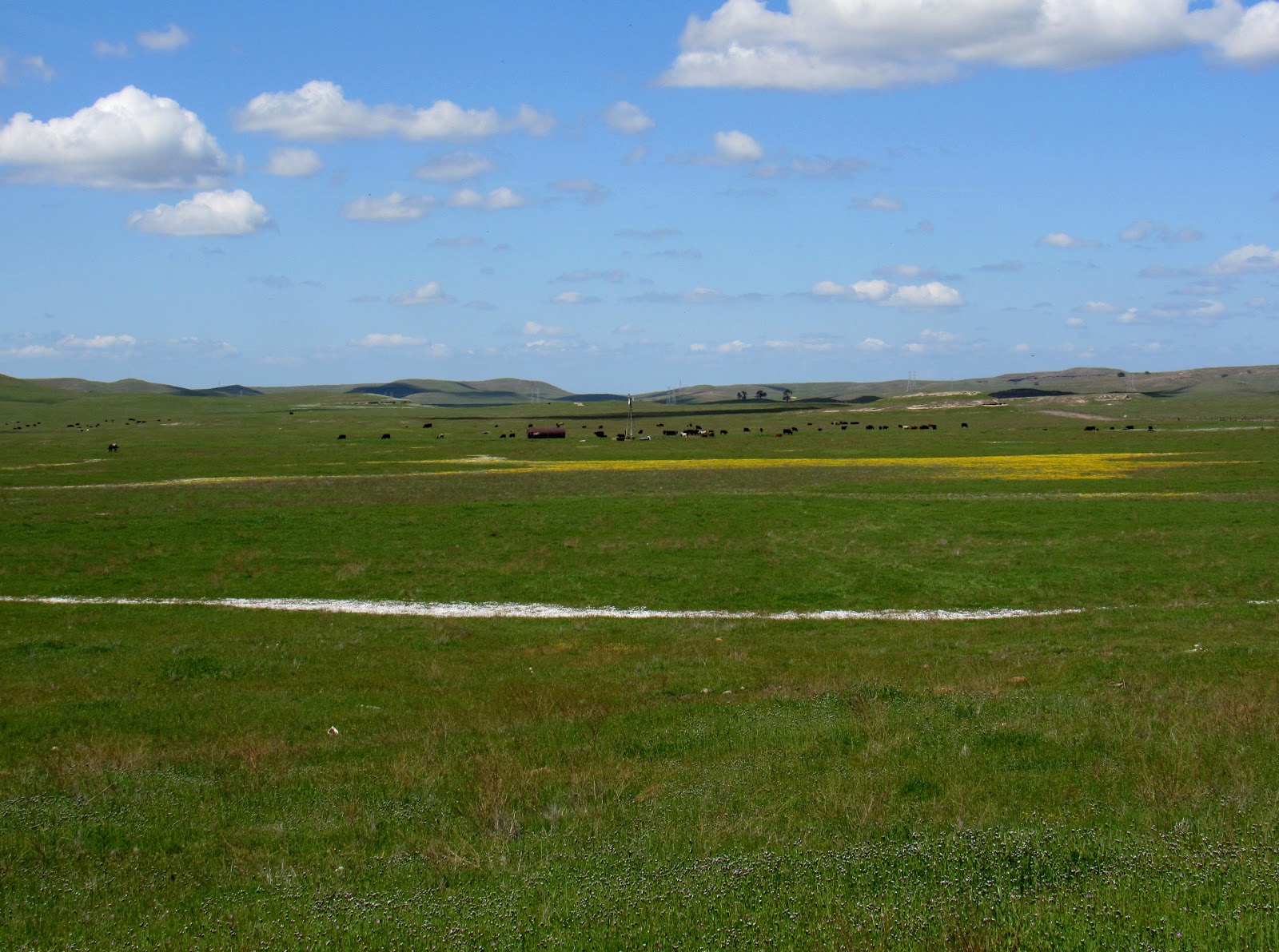 |
| Terrace pools and swales, the presence of which is indicated by swaths and pools of blooming vernal pool wildflowers. |
Marine Terraces
Over the millennia, wave action along California's coast has carved a series of marine terraces, essentially sets of level areas backed by cliffs that stair-step their way up and away from the coast. The oldest terraces, marking the location of the most ancient shoreline (that is still visible) are those farthest from the present-day shore. Each terrace is about 100,000 years older and 100 feet higher than the one below it. While most of these terraces have been eroded away, they are still visible in a few places, like at Wilder Ranch State Park near Santa Cruz, and Jug Handle State Natural Reserve near Mendocino.
The marine terraces at Jug Handle are of particular interest, as the shallow soils of the upper terrace support a unique pygmy forest. The first and youngest terrace nearest the coast supports coastal prairie, while the second terrace, 100,000 years older with better soil development, is covered in coniferous forest. The soils of the third terrace begin to show a change, where standing water on the terrace has leached out soil nutrients; most of the conifers from the terrace below fail to grow here, but Bishop Pine holds out. The fourth and fifth terraces have been so heavily leached that they are deficient in nutrients and highly acidic; furthermore, a layer of hardpan exists about a foot beneath the surface. Plants that grow here are stunted, resulting in a pygmy forest of dwarfed Mendocino Cypress, Bolander Pine and Bishop Pine, along with acid-loving shrubs like California Rose-Bay, huckleberry and manzanitas.
 |
| Image Source: MichaelKauffmann.net (I recommend this site for a good explanation of and photographic walk through the pygmy forest!) |
Serpentine Soils
No discussion about California's geology and soils would be complete without mentioning serpentine soils. Serpentine, or more accurately serpentinite, California's state rock, is found in patches throughout the Klamath Mountains, Sierra Nevada foothills and Coast Ranges. Serpentine soils account for about one percent of California's land area, but have given rise to a number of unique endemic plants. The product of plate tectonics, serpentine rocks originated at subduction zones along plate boundaries, where igneous rocks of the earth's mantle, high in magnesium, underwent intense heat and pressure. The resultant metamorphic serpentine rocks are greenish in color, though soils that derive from them tend to be reddish due to a high iron content and low levels of organic matter. These soils are low in organic matter because they offer a very difficult growing environment for most plants; the transition to serpentine soil is usually very obvious across the landscape, even to the untrained eye, as it is manifested in an abrupt change in plant cover. These stark boundaries between "regular" soil and those of serpentine origin show up on the landscape as a drastic and well-defined line where plant cover shifts, often from forest to very sparse tree cover, scrubby chaparral, or even open ground with a few scattered shrubs or grasses.
Okay then, why are these assemblages of plants so unique to serpentine soils?
The cause is more than the general thinness of these soils, which are often found on steep and rocky slopes, and it goes deeper than the soil's general lack of organic matter and nutrients. Serpentine has an interesting chemical composition, and the soils that weather from it present a particularly challenging growing environment for most plants. Serpentine soils are exceedingly high in magnesium and low in calcium and potassium; plant intake of what little calcium is available is further reduced by the presence of excess magnesium. In addition to this already difficult combination, serpentine soils are high in minerals that are toxic to plants, like nickel, cobalt and chromium. It's amazing any plants can grow in serpentine soils at all!
But if you've spent much time paying attention to the natural world, you probably have arrived at a conclusion: nature is so perfectly designed, so beautifully balanced and intricately linked, that life always finds a way! Despite their inhospitable nature, serpentine soils have given rise to about ten percent of California's endemic plant species. Some species, known as obligate serpentinophiles, or serpentine endemics, occur only on deposits of serpentine soil, while others are merely able to tolerate it. A good example of a serpentine endemic is the Sargent Cypress (Cupressus sargentii), which grows on serpentine soil in the Coast Ranges from Mendocino County south to Santa Barbara County. To take it one step further, not only is Sargent Cypress found exclusively on serpentine soil, there is a butterfly, the Muir's Hairstreak (Callyophys gryneus muiri), that uses the Sargent Cypress as its sole host plant, thus linking some of California's animal species directly to serpentine soils as well.
Not only are outcrops of serpentine soil high in endemism, they are also refuges for native plants. In grasslands invaded by non-native exotic annual grasses, patches of greener native perennial bunch grass often mark the presence of serpentine soil beneath. This is not so much because our native grasses prefer serpentine soil, but rather due to the native grasses' ability to tolerate serpentine environments reasonably well, while non-natives cannot. In this way, islands of native plants have found refuge on outcrops of serpentine soils in seas of aggressively competitive introduced species.
 |
| Sparse gray vegetation covers rocky red slopes of serpentine soil at Red Hills Area of Critical Environmental Concern in the foothills of the Sierra Nevada. Adjacent hills are covered in a luxuriant growth of exotic annual grasses and native oaks that can't survive the harsh serpentine conditions of the Red Hills. |
The Rain Shadow Effect in California
In my previous post about California's climate, I alluded to ways geology and geomorphology interact with weather patterns and climate to produce California's unique plant assemblages and biodiversity.
While California's decreasing average rainfall from north to south down the length of the state is more or less a product of latitude, atmospheric conditions, and the resulting climate, the pattern of increasing aridity from west to east across the breadth of California is the result of the state's geomorphology.
To understand this, we need to take a look at the rain shadow effect.
In the last post, we left our mass of air moving eastward over the Pacific, following along as it was blown across the ocean by prevailing westerlies. The air was cooled to its dew point by chilly ocean waters and condensed into a thick marine stratus layer, or fog. Then it was drawn east and inland by warmer air over the Central Valley. Now, we'll take a look at what happens when that mass of air encounters California's varied topography.
The first geomorphological obstacle east-bound air masses run up against is the Coast Range (which you will now, hopefully, think of as a mass of folded, uplifted, metamorphosed oceanic crust.) As air moves up the westward, or windward, side of the mountains, it cools slightly, and some moisture condenses out. Just east of the first ridge, the air falls into a series of valleys and warms again, before rising over the crest of the Coast Range, which is around 1,300 feet at Pacheco Pass (less at the Altamont Pass) and around 4,000 feet at the highest peaks. Air moving up the windward side of the Coast Ranges cools yet again as it rises, condenses, and drops some moisture on the west side of the crest. East of the Coast Ranges, the Great Central Valley lies in the mountain range's rain shadow. As air descends into the valley, it warms and holds tightly to its moisture.
But as the air masses move ever eastward, they encounter a much more formidable obstacle: the grand Sierra Nevada and Cascade mountain ranges. At the southern end of the Sierra range, peaks reach heights of 13,000 and 14,000 feet. Even passes over the mountains are high: 8,600 feet at Carson Pass; 8,700 feet at Ebbetts Pass; 9,600 feet at Sonora Pass; 9,900 feet at Tioga Pass. The result is an even more pronounced rain shadow effect on the leeward or eastern side of the Sierran crest. As air masses rise over the mighty Sierra, they are cooled considerably, and most of their moisture condenses out as precipitation on the western slopes of the range. East of the crest, air masses have had basically all of the moisture wrung out of them. These masses then fall along steep terrain into the cold, high elevation Great Basin Desert. The rain shadow of the Sierra Nevada and Cascades is so great that the desert it creates, the Great Basin Desert, stretches nearly 500 miles from the eastern side of the Sierra and Cascade ranges, across Nevada and much of Utah, even reaching north into southern Oregon and Idaho.
 |
| The rain shadow effect in California showing air movement across California from west to east. Air temperature changes due to changes in elevation (orographic effects), which in turn causes wetter windward sides of mountains and dry leeward sides. Image source: snrs.ucmerced.edu |
I hope the last few exhaustive (exhausting?) blog posts have served to inform, enlighten and inspire my readers regarding California's great biodiversity, and the complex suite of interacting factors that have worked together through time to create this magnificently diverse area. And above all, I hope I have done justice to my home state in sharing the many reasons the nature of California deserves our great admiration, appreciation, respect, and protection.


Comments
Post a Comment